.1 MoDi (Monitoring urban areas by means of long term DInSAR time series)

Project

MoDi (Monitoring urban areas by means of long term DInSAR time series)

Funded by

ASI-ESA-BIC LAZIO

Period of activity

2013 - 2015

Activities
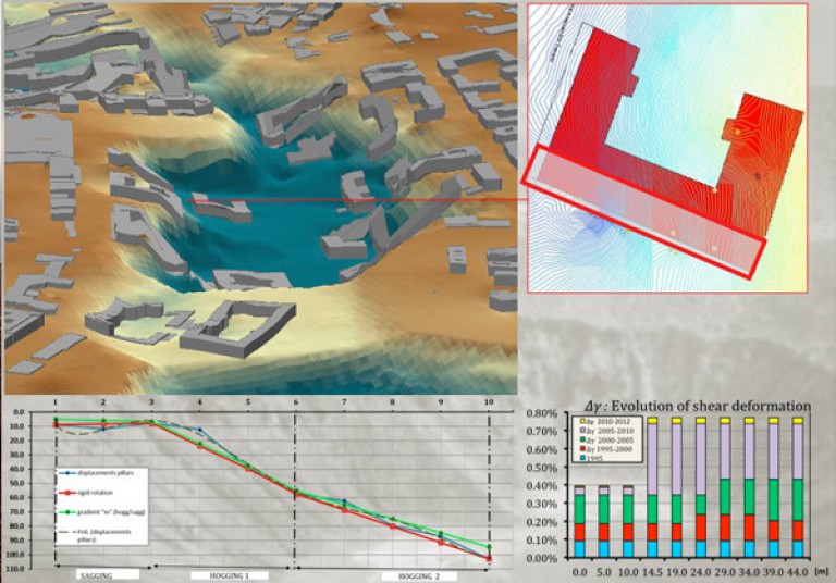
Analysis of SAR data acquired by satellite sensors for the study of the effects of subsidence in urban areas, aimed at assessing the damage on structures and infrastructure.
.2 World HEritage monitoring by Remote sEnsing (WHERE)

Project

World HEritage monitoring by Remote sEnsing (WHERE)

Funded by

ASI

Period of activity

2012 - 2014

Activities
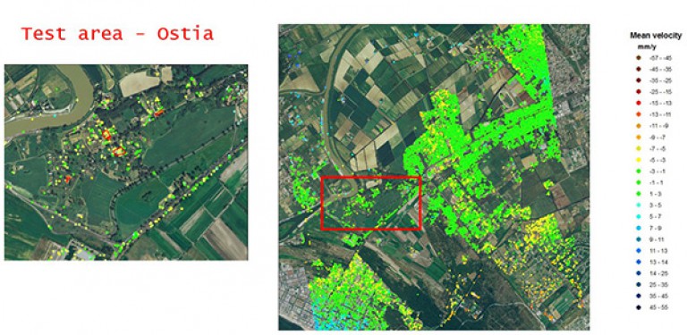
Implementation of a SAR data processing chain for monitoring buildings and structures of historical interest. The processing chain is a part of an efficient and low-cost operational service based on satellite imagery, for a short period monitoring of UNESCO sites and archaeological sites in urban areas. www.progetto-where.it
.3

Project

"Technological Promoters for Innovation"

Funded by

Province of Rome

Period of activity

2013 - 2014

Activities
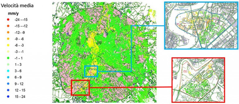
The project, developed in response to the announcement "Technological Promoters for Innovation" of the Province of Rome, focuses on the use of DInSAR satellite monitoring methodology for the control of structures and buildings in urban areas. The data acquired by satellite are processed to create displacement maps of the investigated areas, and identify the presence of critical situations. Measured Velocity of displacement are then used to calibrate a simplified model aimed at assessing the damage that the structure can undergo.
.1 MED_SUV - MEDiterranean SUpersite Volcanoes

Project

MED_SUV - MEDiterranean SUpersite Volcanoes

Funded by

FP7 European framework programme

Period of activity

2013-2016

Activities
Development and testing of a tool for the automatic processing of frames extracted from a surveillance camera network in order to obtain geometric and thermal parameters useful to monitor the evolution of the lava field.
.2 Survey at Lugnano in Teverina (VT)

Project

Survey at Lugnano in Teverina (VT)

Period of activity

2010

Activities
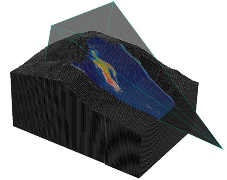
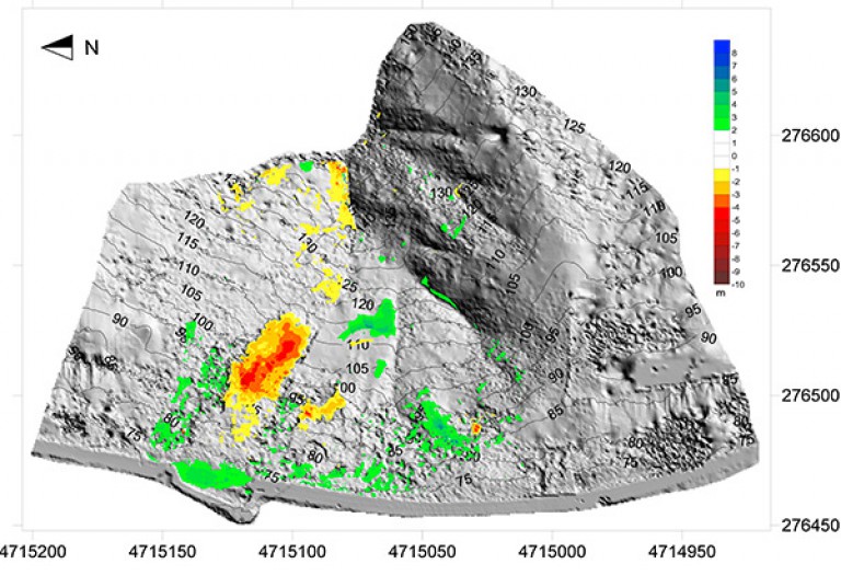
Terrestrial Laser Scanner survey of a landslide, construction of the three-dimensional model and monitoring the evolution of the slope by using digital terrain models
.3

Project

Period of activity

2018 -2021

Activities
.4

Project

Period of activity

2020-2021

Activities
.1 VIRGO REFERENCE SYSTEM (VRS)

Project

VIRGO REFERENCE SYSTEM (VRS)

Period of activity

2013-2014

Activities
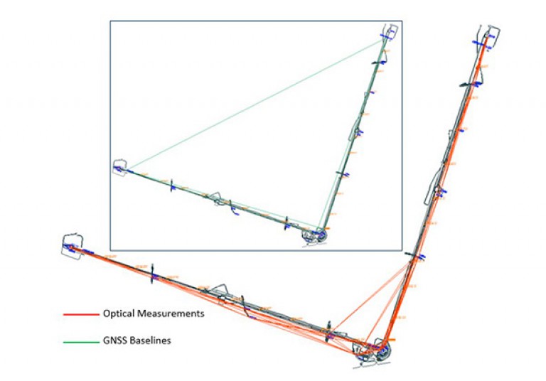
Survey and adjustment of the high-precision topographic reference frame for the Virgo interferometer. The topographic network, surveyed by using automatic total stations and GNSS receivers, was adjusted with a scientific software and used to support the construction of the Advanced Virgo gravitational wave detector, operated by the French-Italian consortium EGO (European Gravitational Laboratory) made by INFN (National Institute of Nuclear Physics) and CNRS (Centre National de la Recherche Scientifique)
.2 SURVEY OF THE SLOPE OF CIVITA DI BAGNOREGIO(VT)

Project

SURVEY OF THE SLOPE OF CIVITA DI BAGNOREGIO(VT)

Period of activity

22-12-2011

Activities
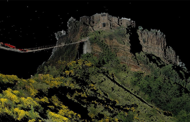
Laser Scanner Survey and three-dimensional modeling of the slope located below the access bridge of Civita di Bagnoregio (VT)
.3 High resolution laser scanner data processing, generation of three dimensional model of Pizzi Deneri Observatory (CT)

Project

High resolution laser scanner data processing, generation of three dimensional model of Pizzi Deneri Observatory (CT)

Period of activity

05-12-2012

Activities
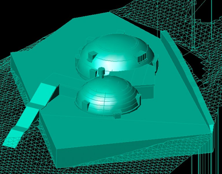
Laser Scanner Survey and three-dimensional modeling of the Pizzi Deneri Volcanological Observatory - Mount Etna (CT). The survey was conducted on behalf of the National Institute of Geophysics and Volcanology - Section of Catania, for the modernization that will affect the structure
.4 Rock cut city of Vardzia (Georgia) reverse engineering by using an high accuracy laser-scanner

Project

Rock cut city of Vardzia (Georgia) reverse engineering by using an high accuracy laser-scanner

Period of activity

02-07-2012

Activities
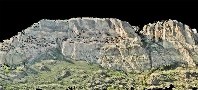
Reverse engineering of the Cave Monastery of Vardzia, carved into the side of Mount Erusheli, in south Georgia. The activity was conducted as part of a project developed by an Italian team, in collaboration with the National Agency for Cultural Heritage Preservation of Georgia, aimed at monitoring the stability of the site
.5 Three-dimensional high-resolution model of the bas reliefs of the battles of Brescia and Ravenna at the tomb of Gaston de Foix - Castello Sforzesco in Milan

Project

Three-dimensional high-resolution model of the bas reliefs of the battles of Brescia and Ravenna at the tomb of Gaston de Foix - Castello Sforzesco in Milan

Period of activity

18-05-2012

Activities
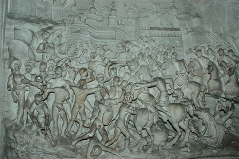
Three-dimensional survey, using Laser Scanner/photogrammetric techniques, aimed at reconstructing the plates representing the Battle of Brescia and of Ravenna, at the tomb of Gaston de Foix, (Castello Sforzesco –Milan). Extracted three-dimensional models have been used for an audiovisual exhibition on Gaston de Foix.
.1 Caditoie 2010/2011

Project

Caditoie 2010/2011

Period of activity

2010 - 2011

Activities
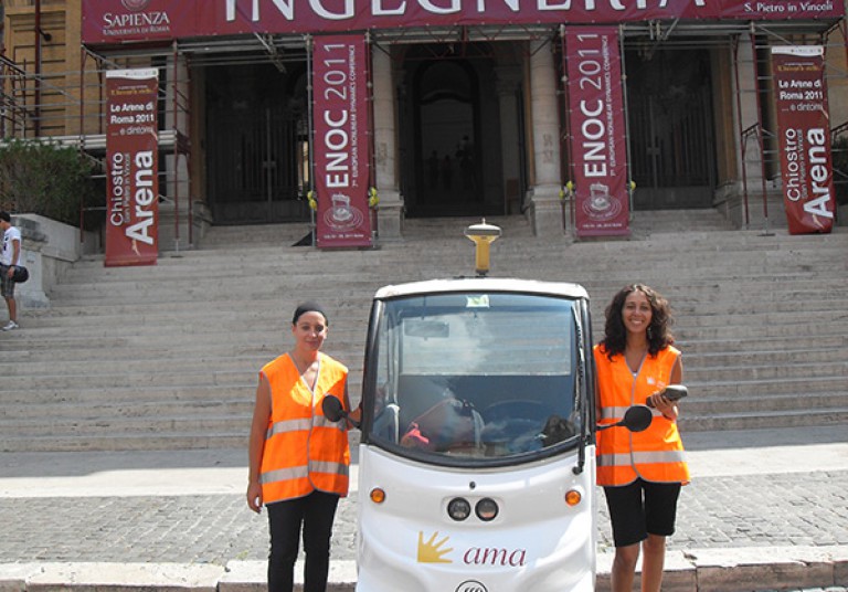
Census of the drains/gratings of the town of Rome with GNSS and GPS-GIS receivers. The project was conducted in collaboration with SysdecoItalia s.r.l. on behalf of AMA, company of the municipality of Rome, which is in charge of the maintenance of drains and treatments against the tiger mosquito
.2 Presidenza della Regione Lazio/Commissario delegato per il superamento dell’emergenza determinatasi in relazione agli eventi atmosferici che hanno colpito il territorio nazionale nei mesi di novembre e dicembre 2008

Project

Presidenza della Regione Lazio/Commissario delegato per il superamento dell’emergenza determinatasi in relazione agli eventi atmosferici che hanno colpito il territorio nazionale nei mesi di novembre e dicembre 2008

Period of activity

01-02-2011

Activities

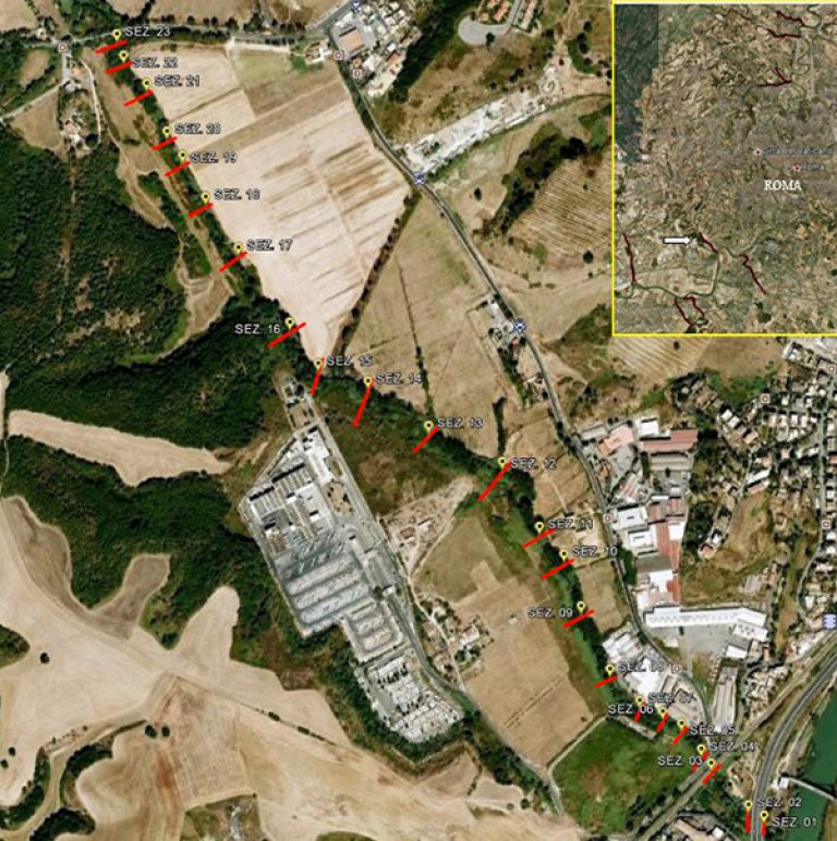
  1. SUPPLY AND INSTALLATION OF STAFF GAUGES AT FLOW RATE MEASUREMENT SECTIONS
  2. SURVEY AND ZERO MEASUREMENT AT THE STAFF GAUGES
  3. PLANOALTIMETRIC SURVEY OF THE LEVEES AND THE EMBANKMENTS OF THE TEVERE RIVER
  4. MONITORING OF SURFACE WATER RESOURCES OF LAZIO REGION WITH INTEGRATED PORTABLE SYSTEM (STI) AIMED AT REAL-TIME MEASUREMENT OF SPEED AND FLOW THROUGH ACOUSTIC DOPPLER PROFILER (ADP) AND TRADITIONAL METHODOLOGY

Questo sito utilizza cookies di profilazione propri e di terze parti per assicurare una migliore navigazione. Per saperne di più sull’uso dei cookies, clicca qui. Se prosegui la navigazione nel sito, acconsenti all’uso dei cookies.

Accetto